- 103 R& D Centers.
- 19 Universities.
- 158 Engineering Colleges.
- 114 Medical, Dental, Ayurvedic, Unani & Para-Medical Institutions.
- 181 Polytechnics.
- 1003 Industrial Training Institutes.
- 47 International Schools
- Karnataka IT Hub of India
- 743 MNCs.
- 87 SEI CMM Level-5 IT companies in the world, there are 63 in India-out of which 32 – i.e 50% are in Bangalore.
- 2084 IT Companies.
- 5,50,000 IT Professionals (1/3rd of total IT professionals in the Country).
- 4th Largest technology cluster in the world.
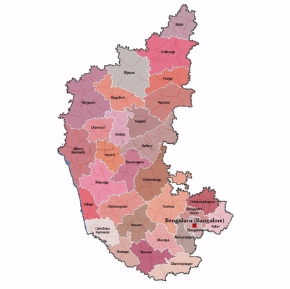
Karnataka State Map

- 8th largest state in India, located on Deccan plateau of India.
- 1,92,000 Sq. Kms in area with 30 Districts, 175 Taluks and 27028 Villages.
- Population: 64.06 million.(2014)
- Average rainfall-50-400 cms & Mean Min. temp: 12.5° to 33°C
- Abode of world heritage & tourist centers.
- Major Rivers: Cauvery, Krishna, Tungabhadra, Netravati, Kali, Kabini, and Hemavathy.
- Literacy rate 75.36 %.
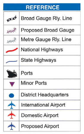
- 7 National highways of 3,742 Kms & 9,829 Kms of State Highway.
- Airports in 6 cities: Bangalore, Mangalore, Hubli-Dharwad, Belguam, Mysore, Toranagallu.Intercity connectivity by air within state.
- 320 Kms of coastline. 3 Major Ports at Mangalore, Karwar & Belekere, and 5 Minor Ports.
- 3192 Kms of Railways.
- Power: Present capacity: 4363MW. Proposed: 10000 MW. Pioneer state in harnessing alternative sources for energy.
- Rich deposits of iron ore, gold, asbestos, bauxite, chromite, dolomite, kaolin, limestone, magnasite, manganese, quartz, silica, felsite, molding sand, fuchsite quartz and ornamental granites
- Balanced ecology in the state


